In this video I head into southern Utah’s Arches National Park to look for some obscure and difficult-to-find natural and man-made features. I experience both success and failure and see some incredible scenery along the way. Oh, and then I make tacos. (Click here if you can’t see the video below.)
I made a list of all the gear I use on my SUV RVing adventures. You can check it out here. Leave a comment on that page or email me if you have any questions. Hope everyone had a Merry Christmas!
In this video I start off on a brand new adventure to the southern Utah desert. This was one of the best trips I’ve ever been on, so you’re not going to want to miss out on any of the updates! (Click here if you can’t see the video below.)
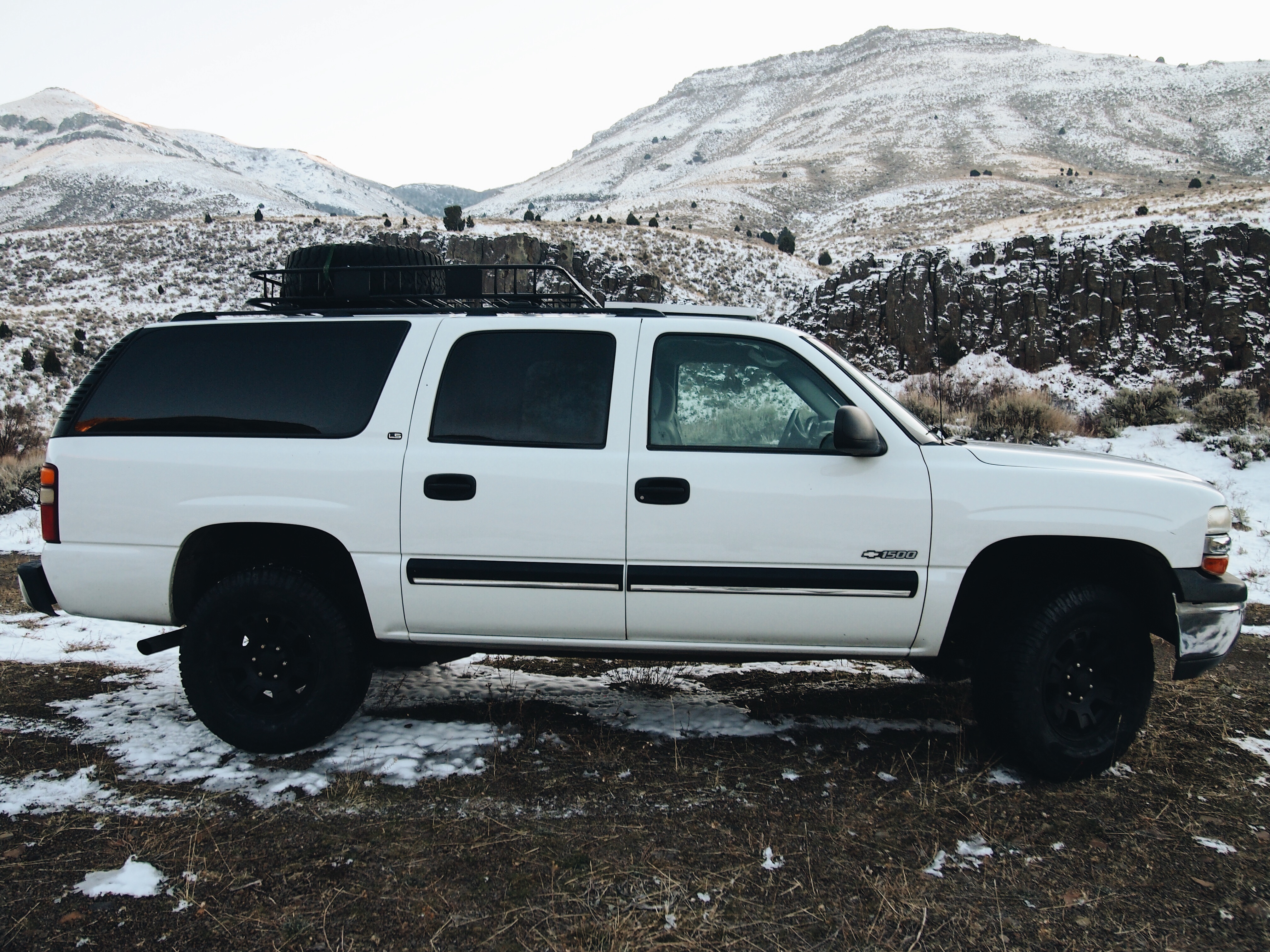
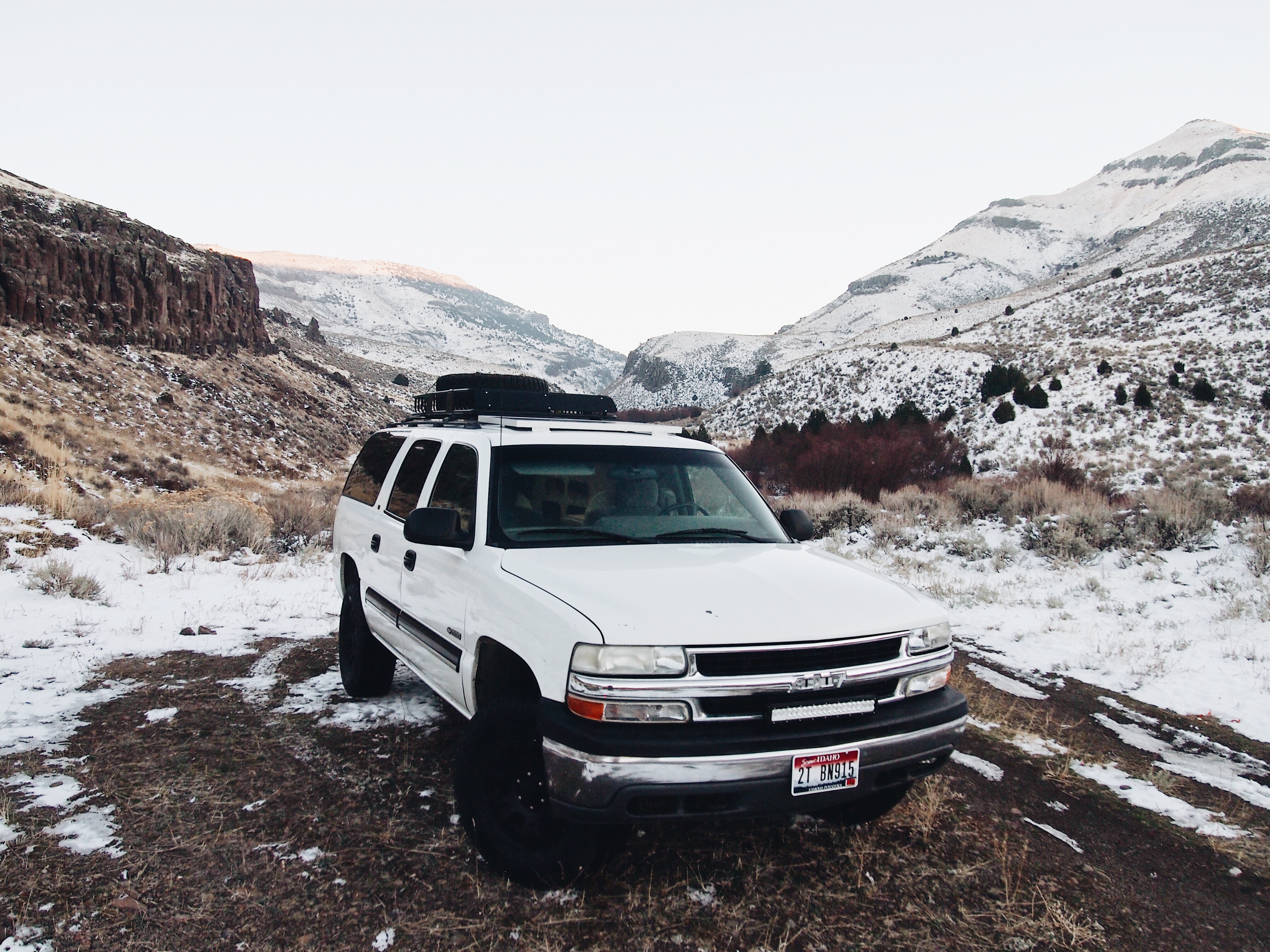
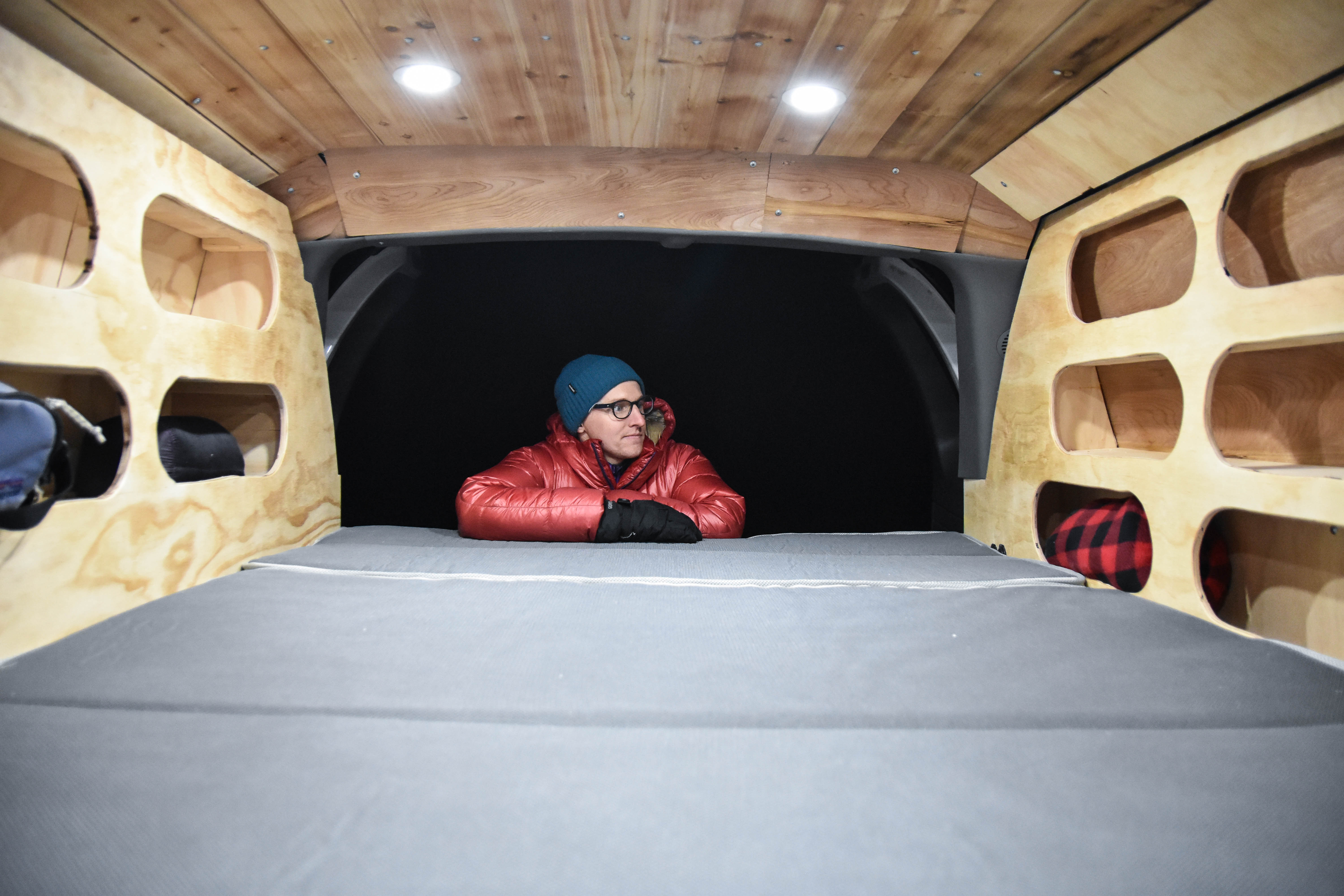
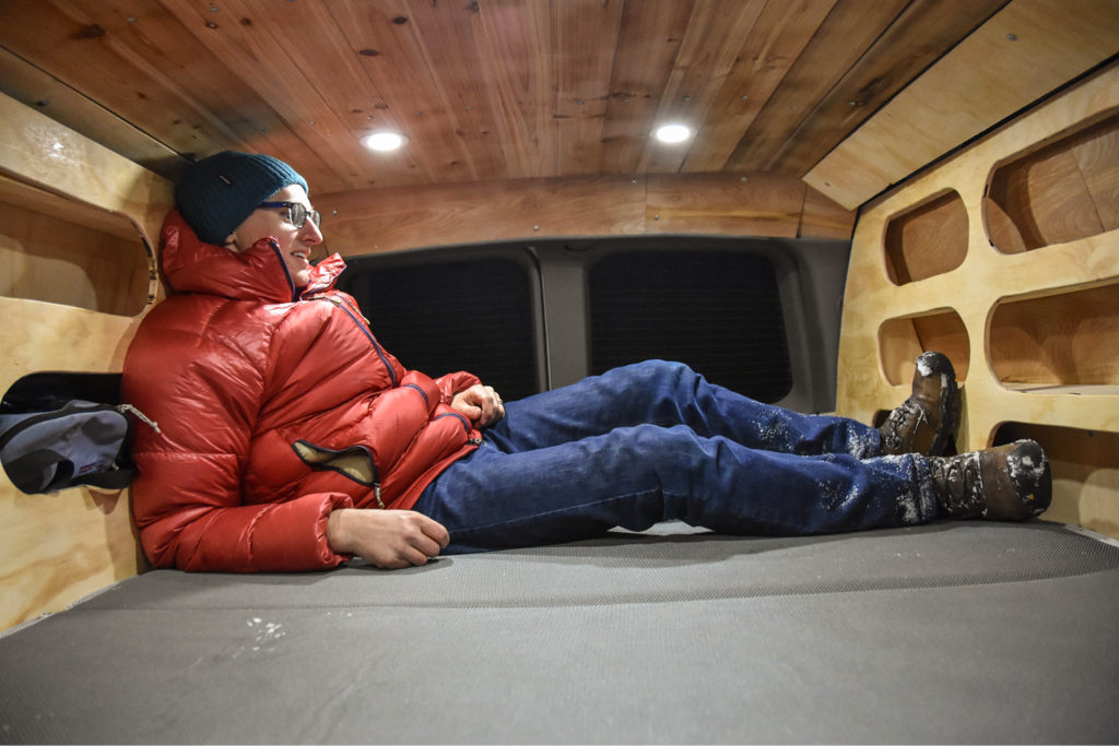
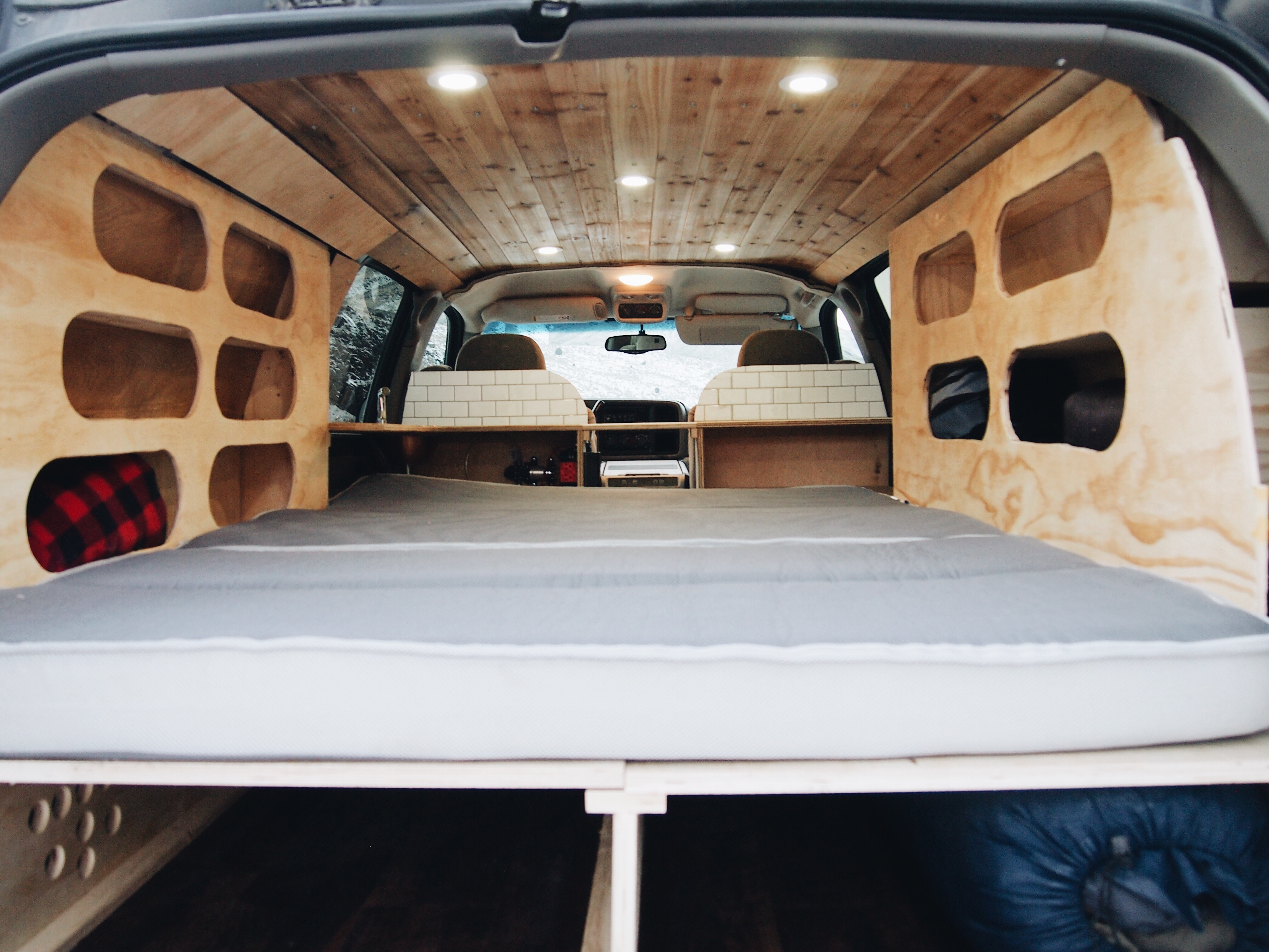
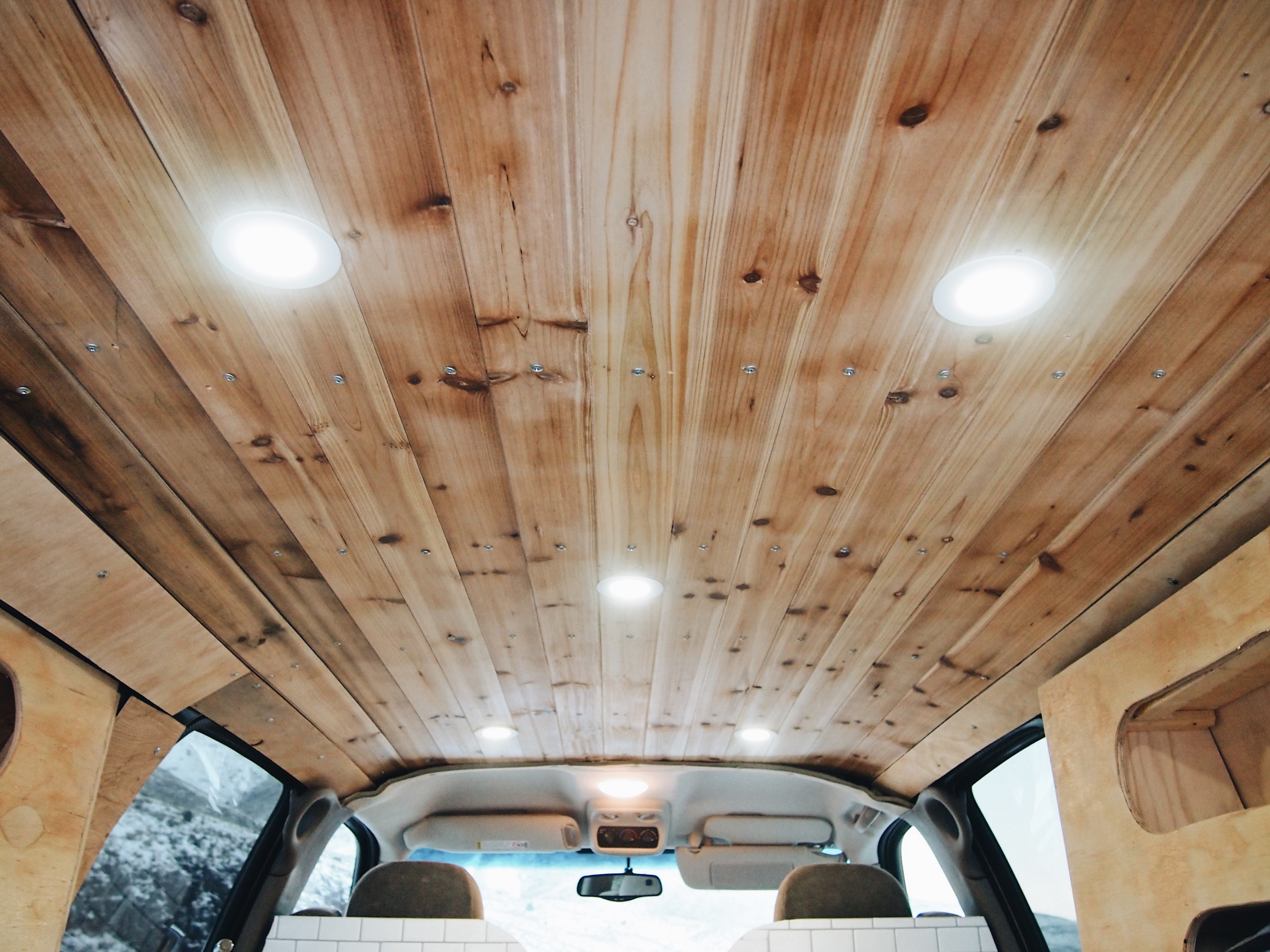
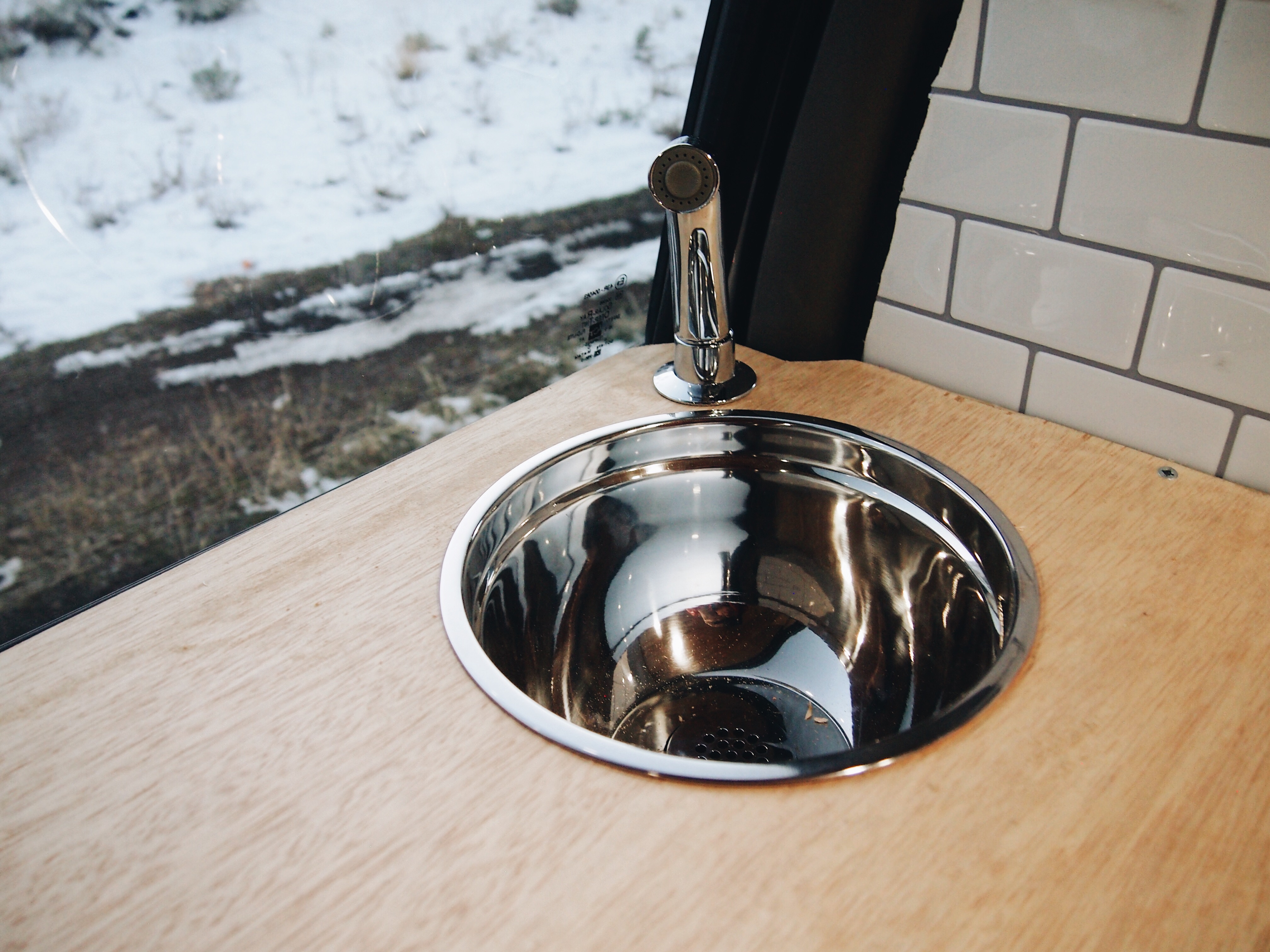
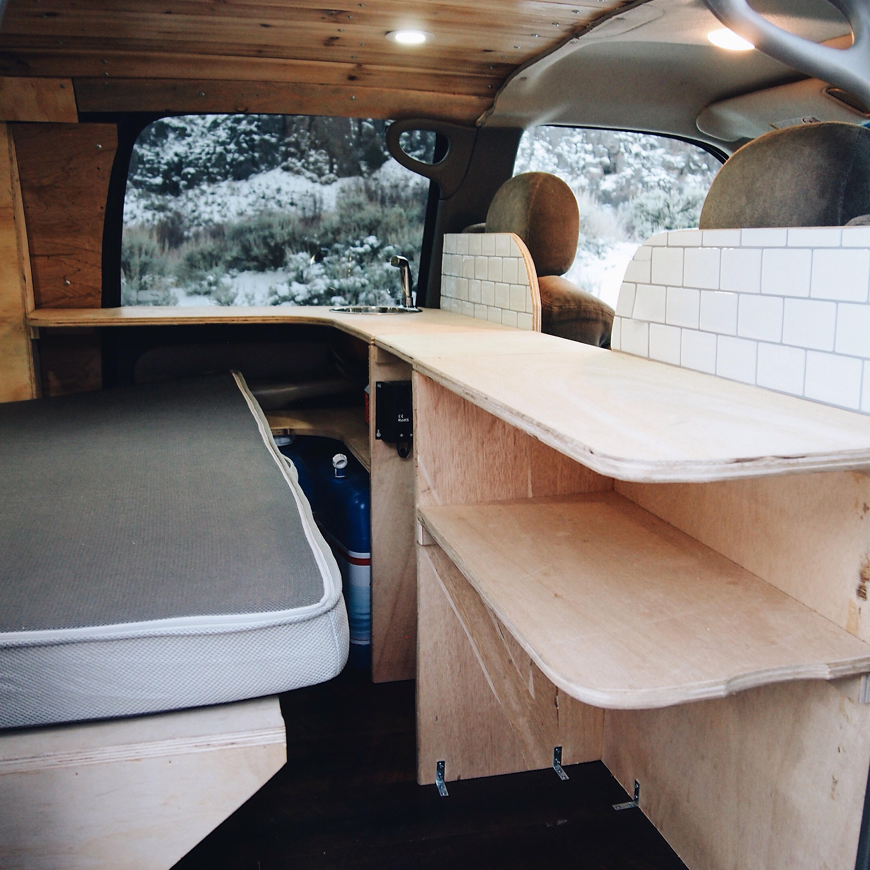
I’m fairly active on Instagram (@suvrving). I go in every day and browse the hashtags for new photos relating to things I’m interested in: #vanlife, #overlanding, #homeonwheels, etc. The other day, while browsing new photos the #overland hashtag, I found the @SubOverland account. A family of 4 was traveling around the US in their 24-foot RV but then downsized to a Chevy Suburban to continue their adventures. This is not your typical soccer mom Suburban (not that there’s anything wrong with that). Here are some features and modifications of their adventure rig:
3-inch lift
Oversize tires
Complete solar setup
Off-road LED light bar
LED interior lights
Roof rack
Refrigerator/Freezer
Power inverter
Kitchen sink
Outdoor shower
Sleeps up to 4
Interior storage
Auto 4X4, 4X4, hi and lo transfer case
Limited slip differential
I was impressed with the pics I saw on Instagram and sent a private message to the account to see if I could repost the pictures here to the blog. Grady, owner of the account and the Suburban, messaged me back and gave me the go-ahead. So here are pics of a 4WD 2000 Chevrolet Suburban that’s been kitted out to comfortably sleep and house a mom, a dad, and two young kids. I can definitely see me getting a rig like this once I have kids. Add a roof top tent once the kids get a bit older and you’ve got separate “rooms” for the parents and kids. If you want a similar rig for yourself, Grady and the gang do beefed up Suburban and Subaru builds. Head on over to SubOverland.com to learn more and get in touch with Grady if you’re interested.
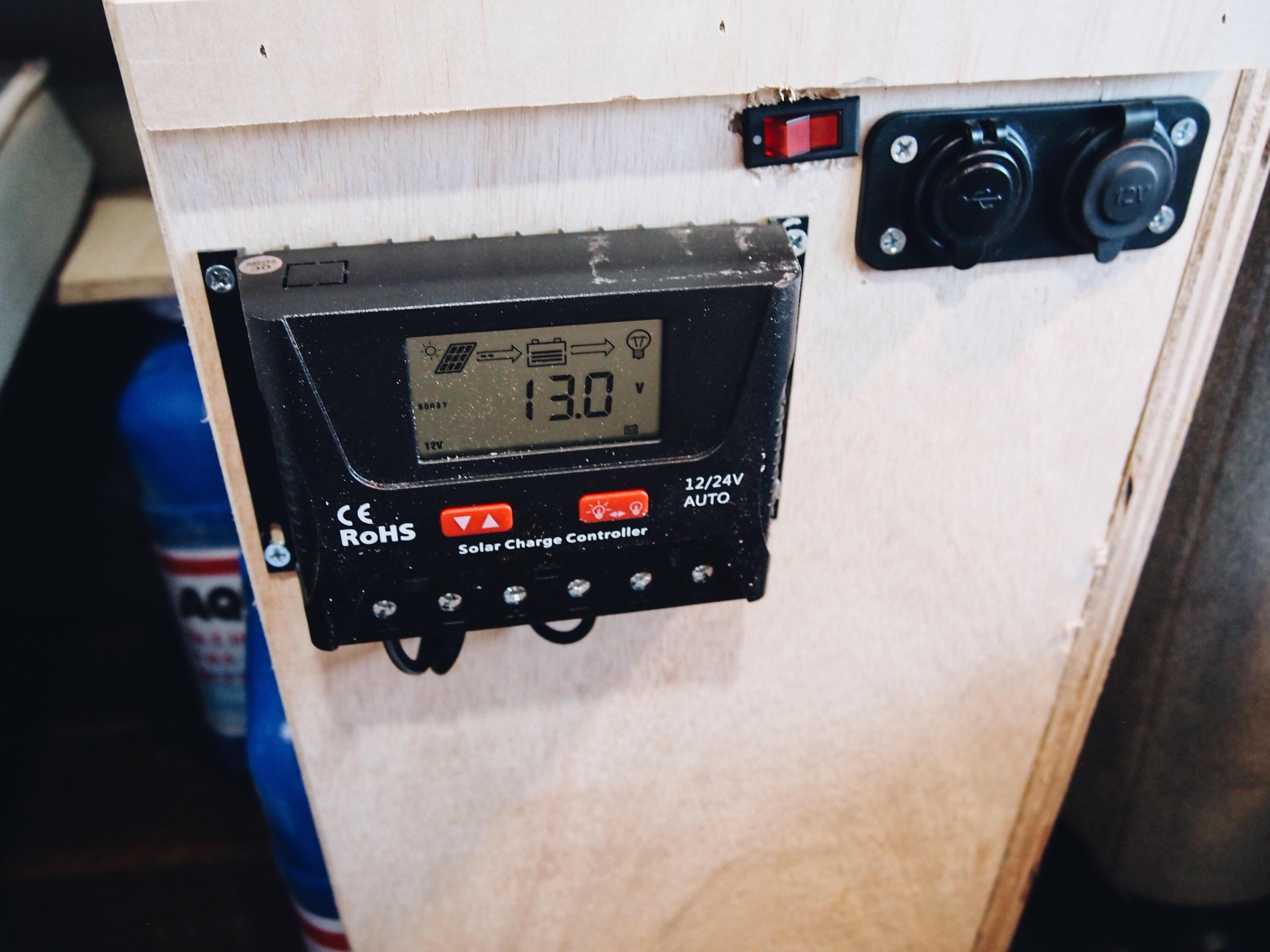
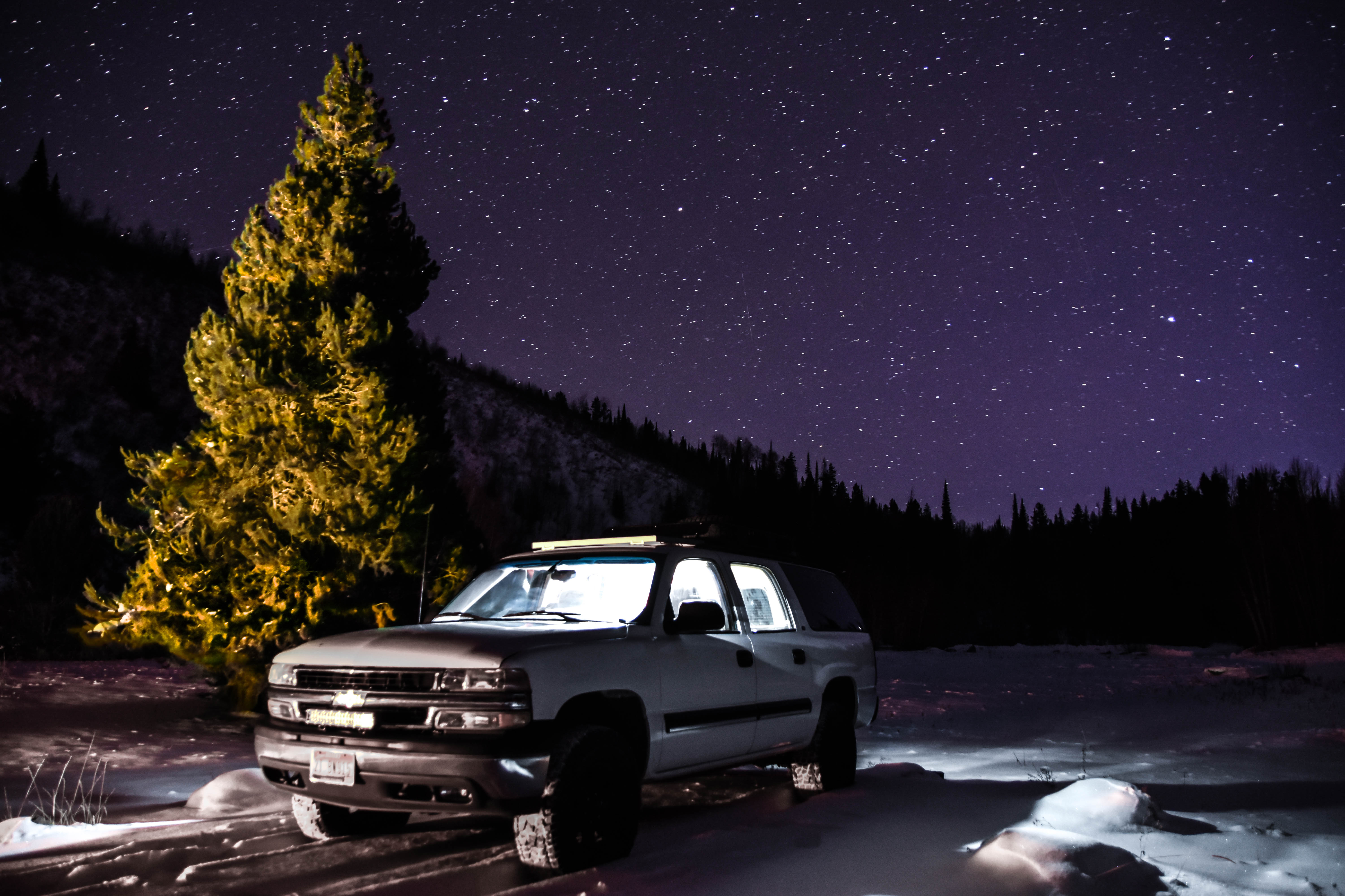
The modified 2000 Chevy Suburban from the outsideAnother look at the exteriorThe sleeping area with storage cubbies on the sidesGrady demoing the sleeping areaLook at all of that under-bed storage!Wood ceiling and lightsSinkThe kitchen/desk/table surfaceThe solar charge controller and a couple of 12-volt outletsSexy outside shot at night
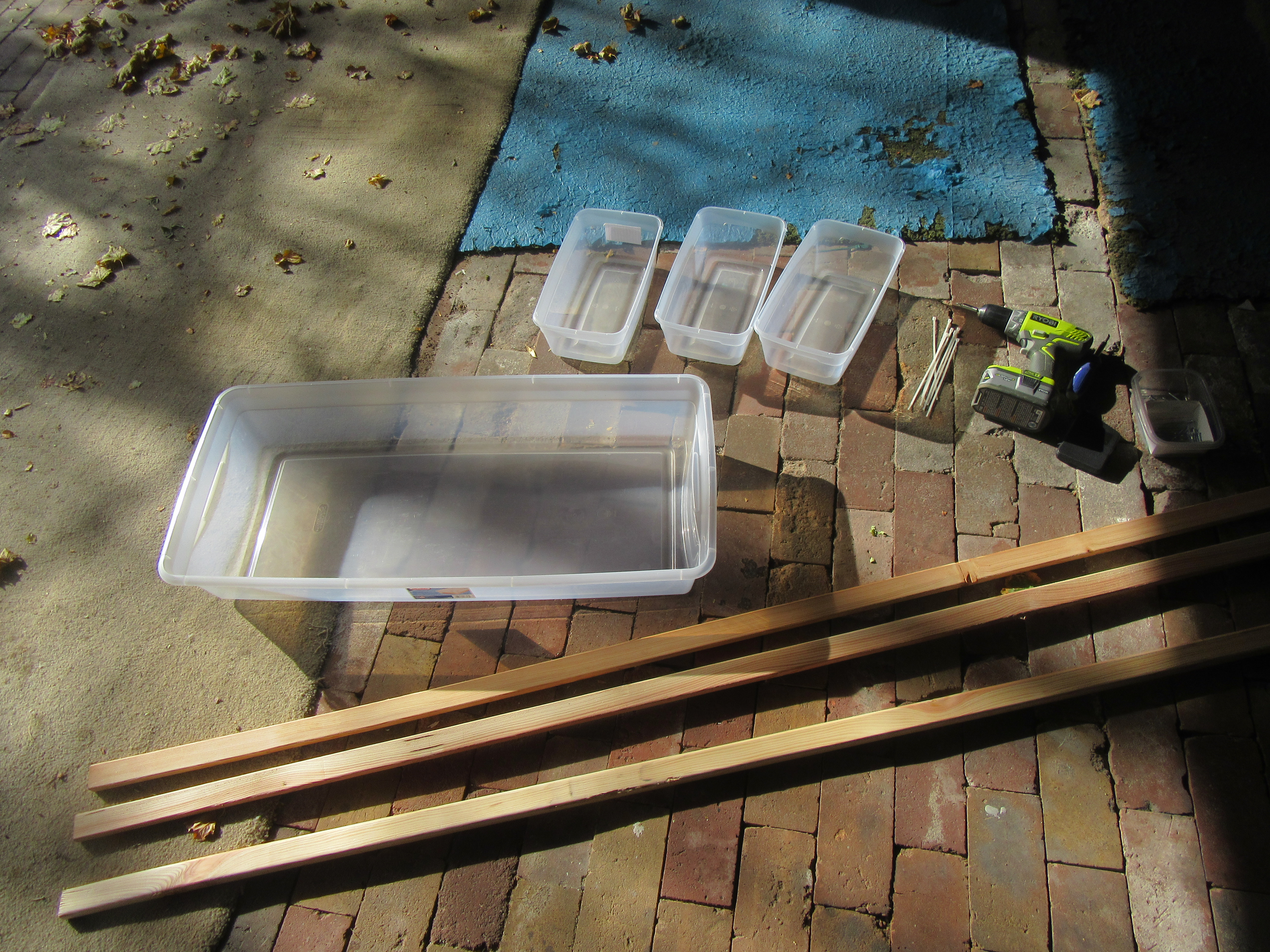
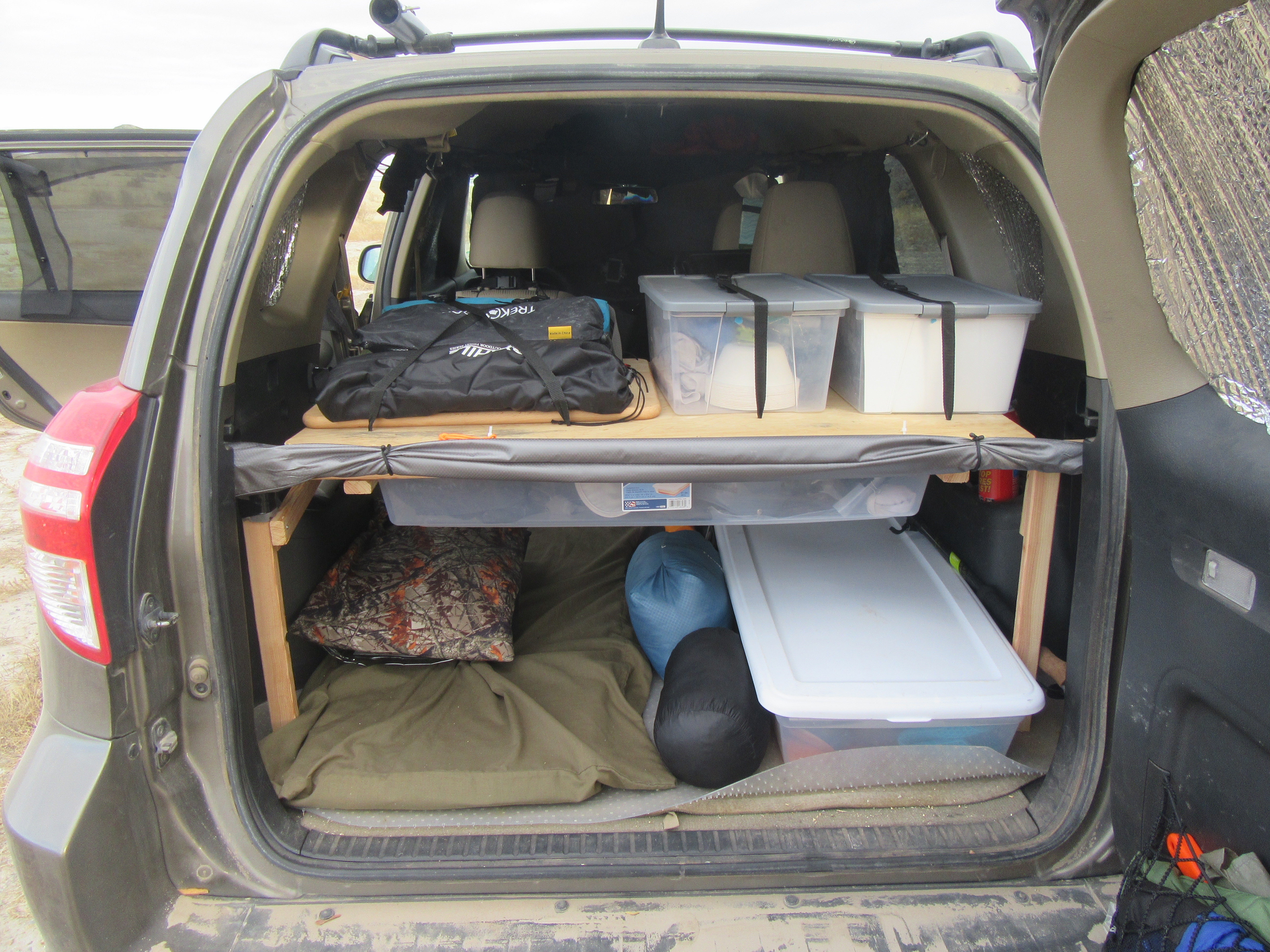
I’ve long said that having a shelf in the back of an SUV is probably the single biggest improvement or modification you can make to your car camping setup. I’ve had and used one for a couple of years, but it was specifically made for my RAV4 (meaning that I couldn’t be of much help when other people asked me how to make a shelf in the back of their SUV), and I felt that I could make an improved version that worked better for my needs. The result is the shelf shown in this video. (Click here if you can’t see the video below.)
And if you haven’t seen it already, be sure to check out this video where I make “drawers” for the top of the shelf.
Here are a couple more pics:
SUV shelf components and toolsThe shelf in action on a trip. Works great!
Surprise! I had hip surgery last week. I’ve mentioned it to a few people in comments and emails, but I didn’t want to really talk about it until it was over. What does this mean for the channel and the online store? Watch this video and find out. At the end of the video I also mention a couple of larger projects coming up that you can look forward to in the coming weeks and months. (Click here if you can’t see the video below.)
In this video I go over the kayaking gear that I take with me on my SUV camping trips and adventures. I’ve always wanted a kayak and finally bit the bullet and got myself one at the start of this last summer. It was definitely worth the investment! I had a great time with it before I had to put it away for the winter.
This video covers info about the kayak, paddle, life jacket, and roof rack kayak holder that I use. I basically got the cheapest pieces of equipment I could find, but they all work really well for me. (Click here if you can’t see the video below.)
Gear in This Video
(Note: The Amazon links below are affiliate links.)
Pelican Trailblazer 100 kayak from Dick’s Sporting Goods. It was on sale for $177 when Dick’s was having a Memorial Day sale.
Kayak paddle – Not sure what the brand is. It was $20 or $25 at Walmart.
Life jacket – $10 at Walmart. It was the cheapest one that wasn’t one of those $5 orange ones.
A very common question from people who want to camp or live in their SUV is how/where they are supposed to go to the bathroom. There are a number of different ways to address this problem, and ny personal toilet solution has 3 components:
I use public toilets whenever possible. This includes toilets at Walmarts, gas stations, grocery stores, fast food restaurants, libraries, visitor centers, trailheads, etc.
I have a pee bottle for when I need to pee inside of my vehicle and don’t want to leave. This can be due to privacy concerns (e.g., there are other people camped nearby) or weather concerns (e.g., it’s cold or rainy outside). I use a green Nalgene bottle.
I have a small, portable camp toilet that I made. I use it in conjunction with a privacy tent when I need to poop and there are no public restrooms around.
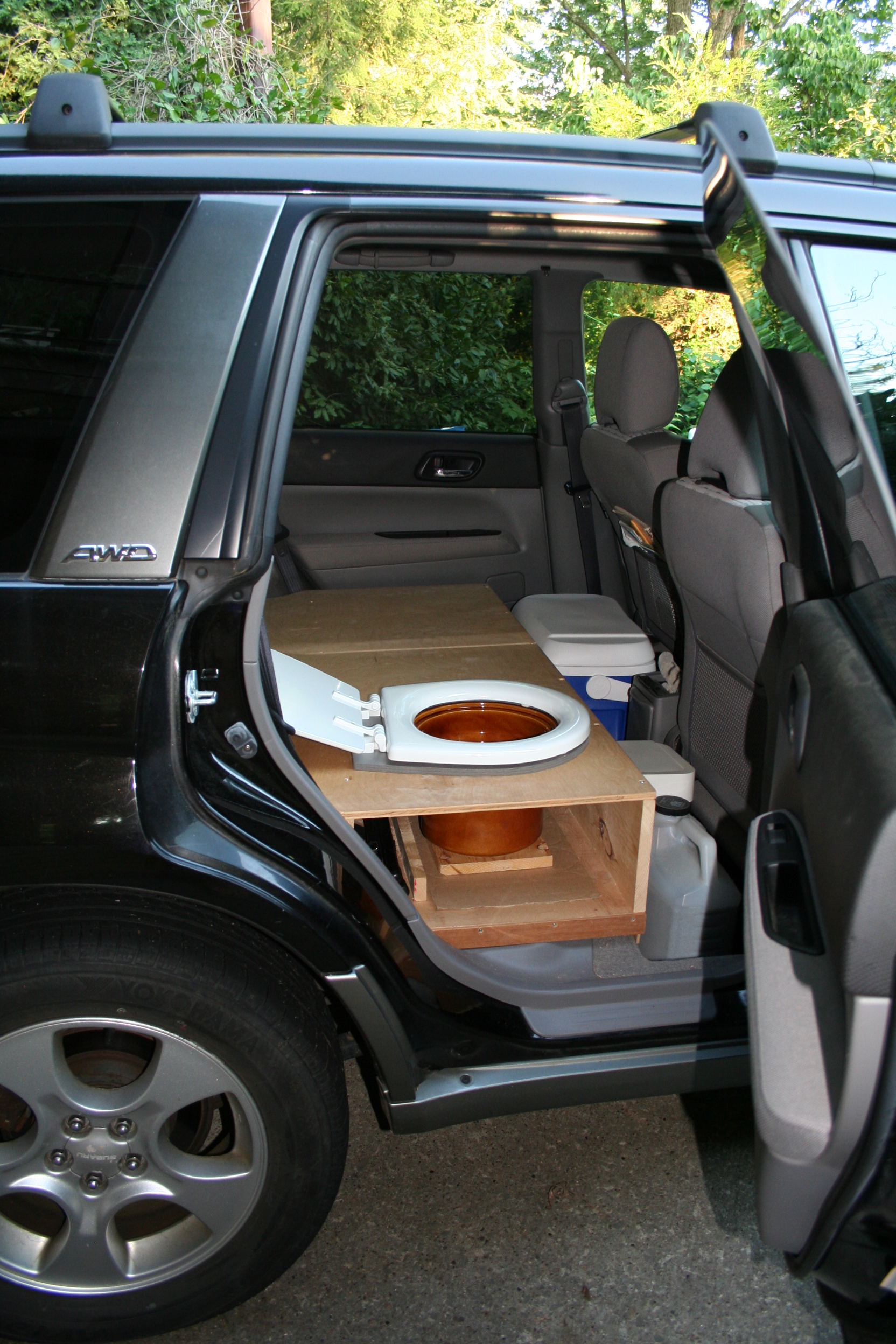
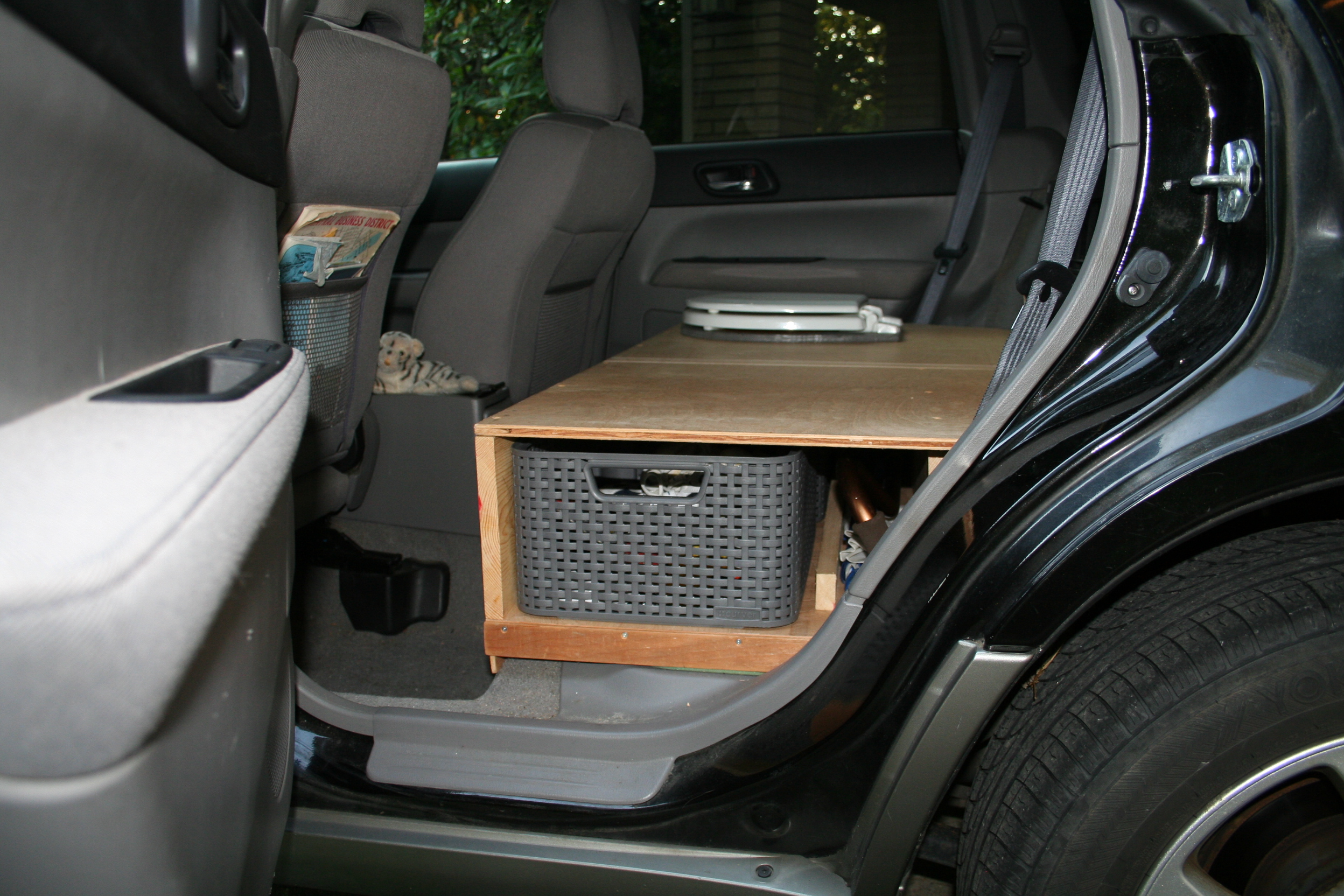
Excuse me while I get a bit graphic here, but I’ve never pooped while inside my SUV. I’ve never really needed to, and the idea of pooping and creating unpleasant odors in such a small space has never appealed to me. That said, different people have different priorities. For some, the best solution is to rig up a toilet inside of their vehicle so they can use it discretely without having to leave the vehicle. A few months back, SUV RVing reader/viewer Rainwood sent me a couple of photos of the toilet she built into the sleeping platform of her Subaru Forester:
A toilet installed in a Subaru Forester.Looking at the toilet from the other side. Note the “drawer” (a basket/bin) that makes the most of the space under the platform.
First, Rainwood removed the rear seats. And then here’s what she had to say about the toilet and how she made it:
“Since I want to be able to sit on my toilet, I found an old crock from a crock pot at a second-hand store. It is just the right height and fit where the back seat was. I found an RV toilet seat on line and built it in. Like I said, I’ll use plastic bags (they fit well) and kitty litter. I got the back windows tinted and am going to put curtains in for privacy.”
If being able to go to the bathroom while inside your SUV is important to you, Rainwood’s design looks like a great one to emulate.
She also had this to say about removing the seats:
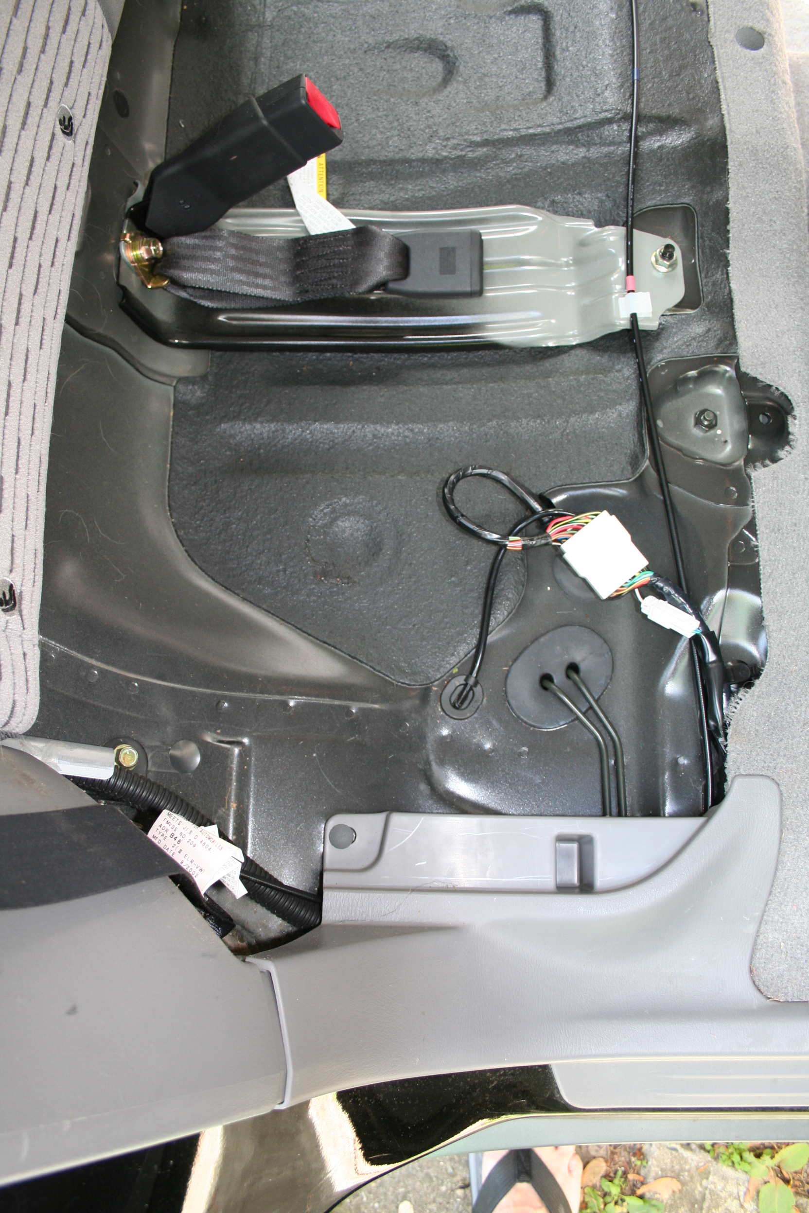
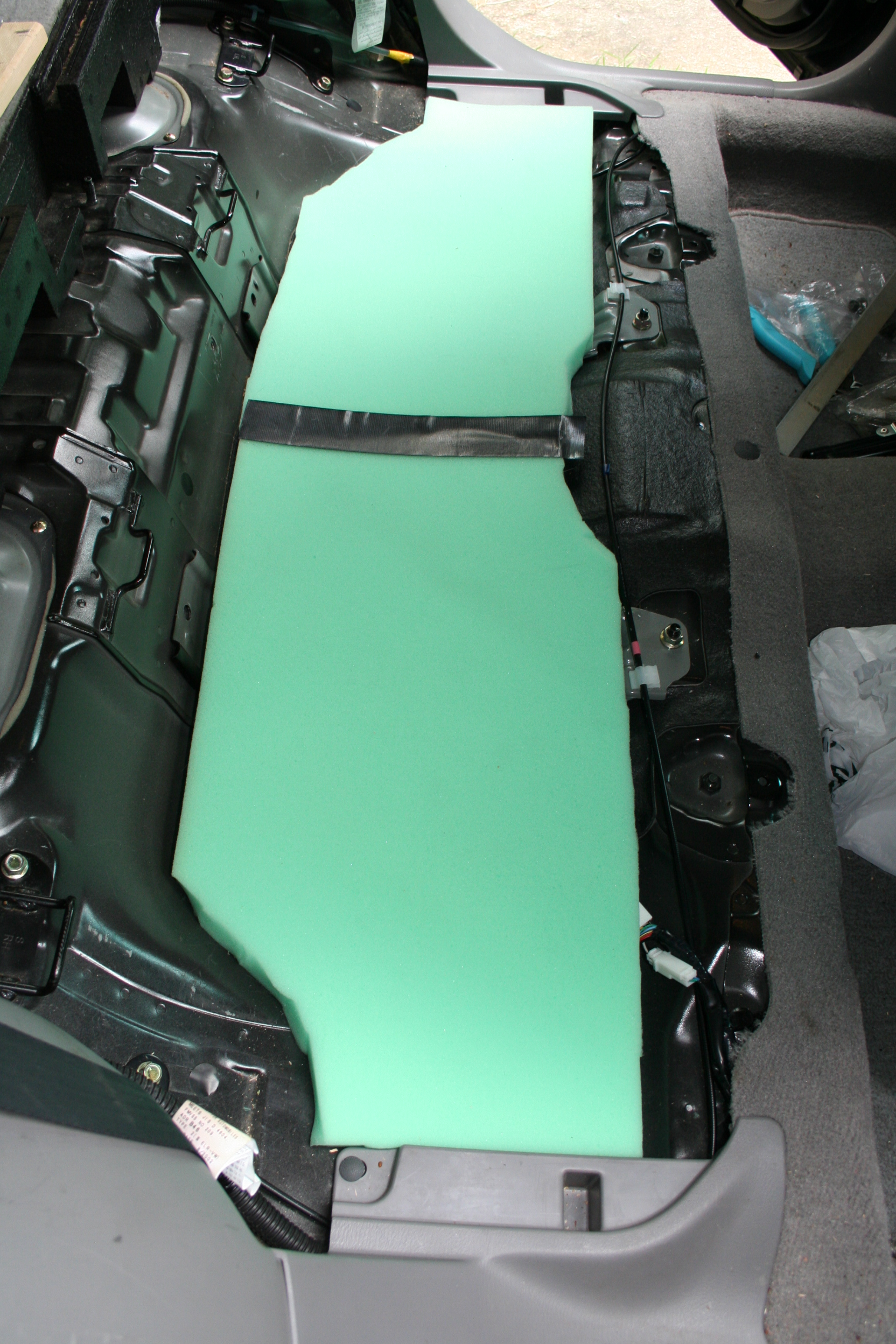
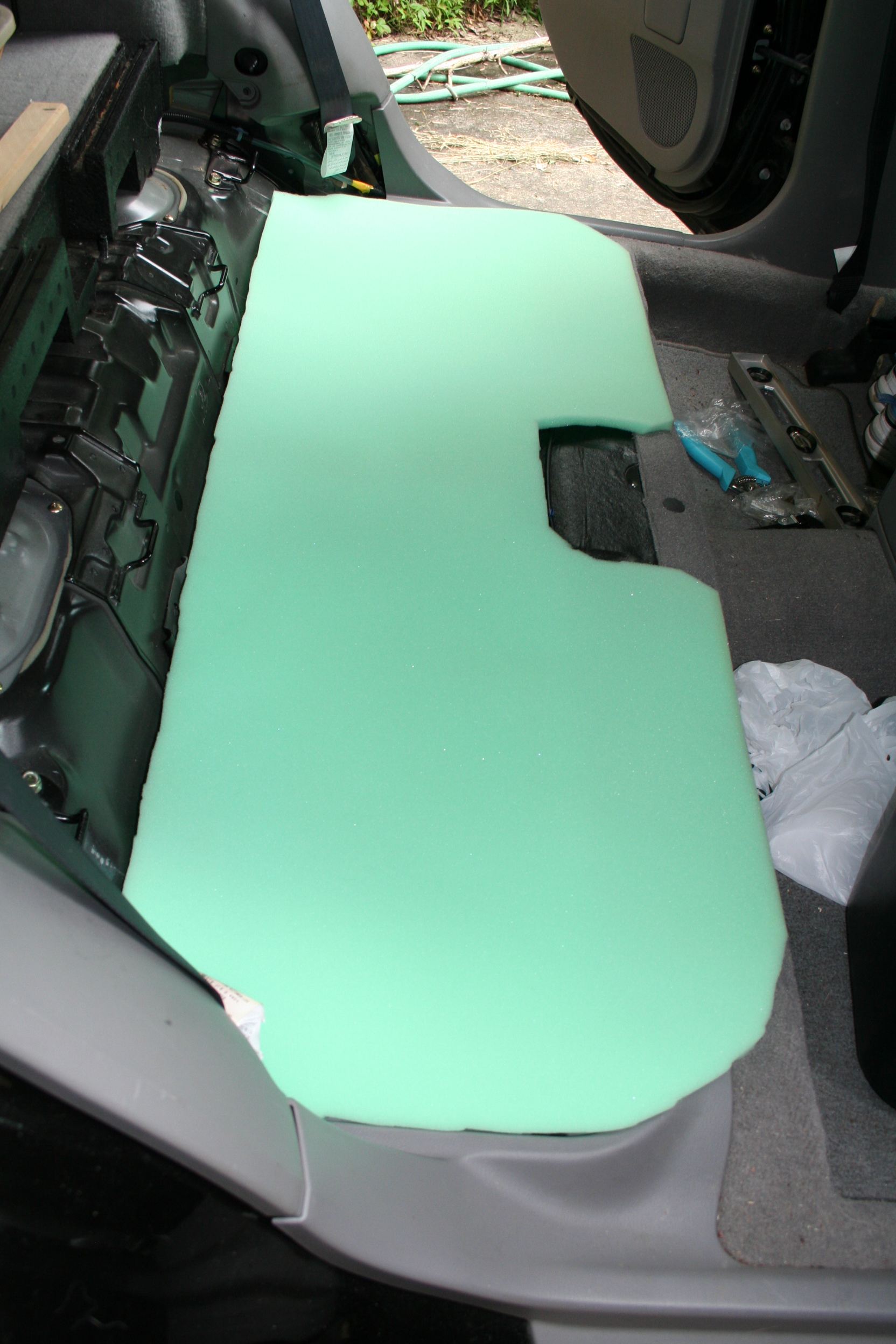
“When I took out the back seats I had to add some foam to fill the space below the first wooden frame. Before placing the foam, there was a lot of noise from gasoline splashing around as I drove.”
And here are some pics of the seats removed and foam she added:
The rear seats removedThe seats and seat backs removed with foam padding placed in the deeper contoursThe second layer of foam padding
Thanks for sharing, Rainwood!
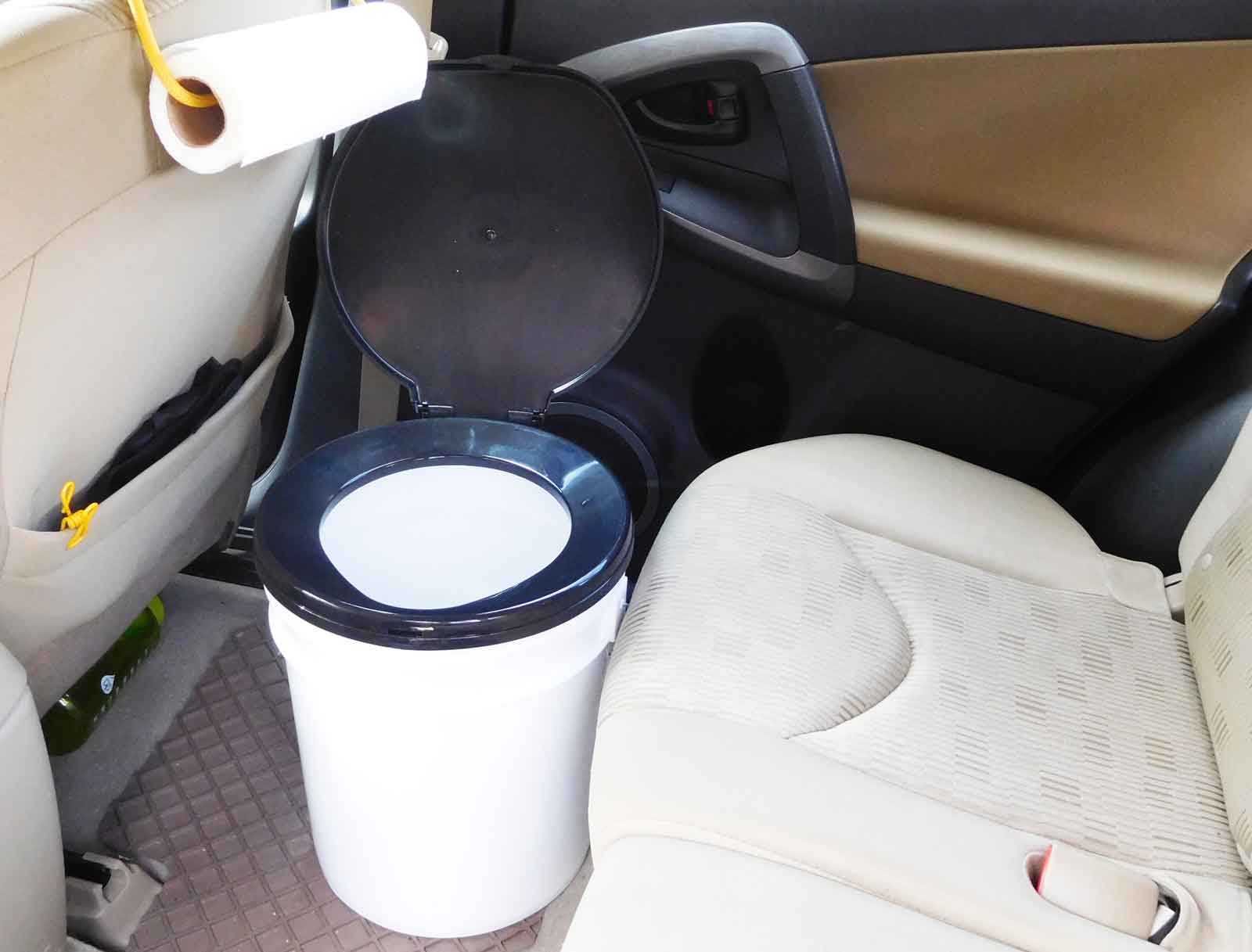
Another option for adding a toilet to your SUV is to simply put a bucket toilet on the floor behind the front seats. I show that in this picture here (this is the toilet seat I bought):
A bucket toilet inside of an SUV
Pictured is a 5-gallon bucket, but you could certainly get a smaller one if you wanted more headroom.
If you’d like to share some pics of your SUV camping setup with the SUV RVing community, get in touch using the form here.
[Note: This article contains Amazon affiliate links for products that I use and have paid for myself.]
In this video I go through my camp kitchen/cooking setup. I cover the tables I use for preparing the food and putting my stoves on, the utensils I carry, the pots and pans I use, and more. (Click here if you can’t see the video below.)
Below is a list of most of the gear I show in the video. I don’t include links to obvious/uninteresting things like the knives or plate. The items below appear roughly in the order that they appeared in the video. (Note: All of the Amazon links below are affiliate links.)
In this video I talk about how much my one-month, 5-state, 4000-mile road trip cost. I break it down into the categories of groceries, restaurants, gas, etc. (Click here if you can’t see the video below.)